EasyPlan
General
EasyPlan covers the whole of
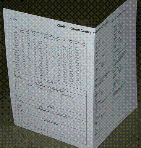
Flight Log
EasyPlan makes it easy to produce a
comprehensive and accurate Flight Log to keep on your knee-board while flying
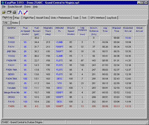
A large number of items can be enabled, or
disabled. All the parameters that you require for your Flight Log, such as
latitude, longitude, bearings, headings, expected arrival times, and fuel are
available. The printout includes columns for you to fill in your revised ETA
and ATA during the flight.
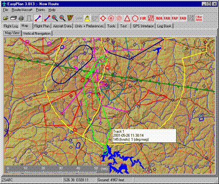
Map View
The entire route can be planned and entered from
the Map View. The following Aeronautical items can be displayed. FIR, CTR, ATZ,
TMA, FAR, FAP, FAD, Special Rule areas, Airfields, VOR, NDB, and Reporting
points. CTA's and UTA's will soon be added.
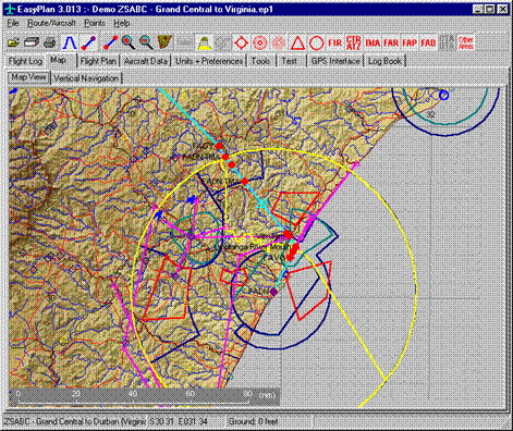
To assist in flight planning rivers, roads,
populated areas, political boundaries and ground elevation can also be
displayed.
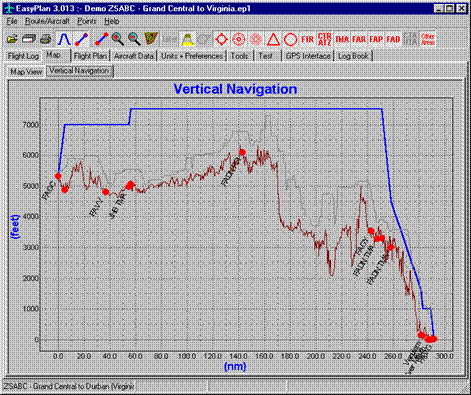
Profile or route:
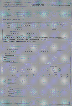
Flight Plan
A Flight Plan is produced in the South African
or Namibian format. This can be faxed directly to briefing.
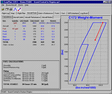
Aircraft Defaults and Weight
& Balance
Weight & balance calculations can easily be
done. The calculated weight balance is shown on a graph against the Envelope
Limit.
Some aircraft default values can be entered and
these are automatically used when creating a Flight Log and Flight Plan.
GPS Intertface
EasyPlan connects to a Garmin GPS:
- Download
a route to the GPS.
- Upload
track flown.
- Display
live update showing position and speed.
User Options
Preferred units and options can be selected.
Tools
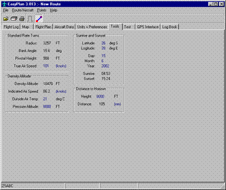
A Turn Rate, Density Altitude and Sunrise &
Sunset calculator is available.
PC Requirements
The following PC specifications are recommended
as a minimum:
- Pentium
III
- 2 GB
free disk space (for hi-res data)
- 256
Meg RAM
- Display
1024x768 256 colours
- Windows
95, 98, NT, ME, 2000 or XP